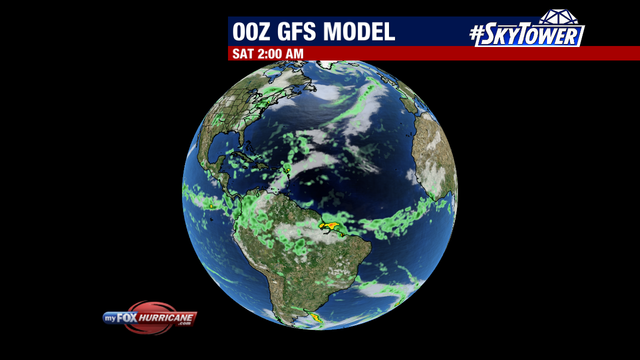
GFS Model | Global View

About this Map
The Global Forecast System is a global numerical computer model run by NOAA. This mathematical model is run four times a day. It is an excellent model in the one- to five-day range. The accuracy drops significantly after day five, and significant long-range forecast changes are noted from run to run.
The graphics above show precipitation rate and mid cloud cover. Light green shades indicate light rain. Yellow and orange shades indicate heavier precipitation. The global perspective of this model is useful in watching tropical waves exiting the African coast and moving into the Atlantic during the Hurricane season.
Remember that these are mathematical models with varying initial assumptions. Thus, different models produce different final results. They do not necessarily reflect the "official" hurricane track issued by the National Hurricane Center. Forecasters review all of the model data but use their own experience and scientific expertise to arrive at a final forecast.
Additional Weather Maps
-

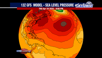
GFS Model | Atlantic
-
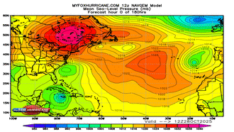
NAVGEM Model | Atlantic
-
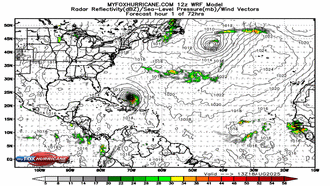
WRF Atlantic Model
-
ECMWF Model | Caribbean
Storm Preparation Guide
county-by-county pages
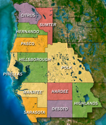 Click on your county above for specific evacuation zones, and emergency contacts.