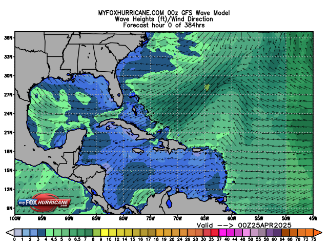
Forecasted Caribbean Wave Heights

About this Map
The Global Forecast System (GFS) is a global numerical computer model run by the National Center for Environmental Prediction (NCEP). This mathematical model is run four times a day. The model does not predict individual wave heights but the expected wave field, which is an average of wave heights over a large area. The average that is commonly used by meteorologists is the significant wave height, which is defined as the average height of the highest 1/3 of all individual waves.
The GFS output uses color coding to identify significant wave heights. Smaller wave heights are shown in blue hues and larger wave eights are shown in yellow and red hues. Because smaller waves are not easily seen against the background of larger waves, the significant wave height corresponds to what an observer would believe to be the average wave height. It is important to realize that the largest individual waves, however, embedded in the overall wave field are approximately twice as high as the significant wave height. So, in a large field of significant wave heights of 10 feet, there are likely to be individual waves with heights of 20 feet, as well as, waves less than 5 feet.
In addition to wave heights, the GFS forecasts wind speed over ocean areas, as well. White arrows indicate wind direction and speed. Short arrows are light winds and longer arrows show stronger winds.
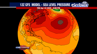
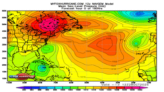
Additional Weather Maps
-

GFS Model | Atlantic
-
NAVGEM Model | Atlantic
-
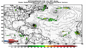
WRF Atlantic Model
-
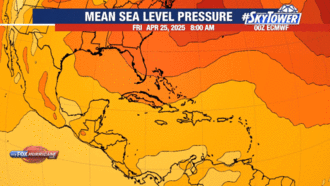
ECMWF Model | Caribbean
Storm Preparation Guide
county-by-county pages
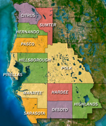 Click on your county above for specific evacuation zones, and emergency contacts.